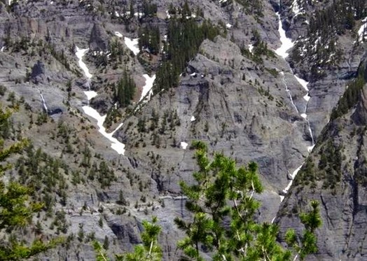
"Travel is fatal to prejudice, bigotry, and narrow-mindedness, and many of our people need it sorely on these accounts. Broad, wholesome, charitable views of men and things cannot be acquired by vegetating in one little corner of the earth all one's lifetime"-MARK TWAIN

Sunday, June 8, 2014

Big Meadows


Just East of the summit of Wolf Creek Pass, near Pagosa Springs, CO, you will find Big Meadows Recreation Area and campground.  From what I understand, the campground has been closed for the past few years while the pine beetle devastation was removed.  It reopened this past Fall.  The entire campground has been rebuilt from the ground up, so to speak.  All new sites, many with decks and rails.  No hookups, but who needs them with the scenery available.

IMG_3078 (Medium)

We met up with some good friends from Arizona that were returning from an Escapee event in Indiana.  Knew we would cross paths somewhere, and Big Meadows filled the bill.  As you can see, the sites are well spaced, and there weren’t many folks there the middle of the week.

IMG_3826 (Medium)

We spent two days catching up on each others travels and such. 

The lake was a hotspot for the local fishermen, and ladies.  Some fishing, and some catching.

IMG_3830 (Medium)

IMG_3833 (Medium)

We took a walk around the lake one morning.  About three miles.  Lots of running water.

IMG_3832 (Medium)

IMG_3072 (Medium)

IMG_3836 (Medium)

IMG_3837 (Medium)

Some of us got a little warmer than others.  This is the dog that doesn’t like water.

IMG_3843 (Medium)

And, of course what enters the lake this time of year has to exit the lake.  A pretty bridge over the spillway, which was rushing with whitewater.

IMG_3040 (Medium)

IMG_3064 (Medium)

A great time with great friends.

IMG_3037 (Medium)

Onward and upward…….jc

Friday, June 6, 2014

Jeep Ride


Our second full day in Ouray, we decided to rent a jeep and head up into Yankee Boy Basin.  As the road closure had put a crimp in the tourist numbers, the owner of ColoradoWestJeeps made us a good deal for the day.

DSC_1538 (Medium)

Seems we can’t get a sunny day up in the basin.  When we were here in 2012, it rained the entire time we were up there.  Though this day dawned clear and sunny, by the time we got on the road the clouds had moved in.  Made most, if not all, the photo’s flat.

Everywhere direction you looked, there was falling water.

DSC_1467 (Medium)

DSC_1468 (Medium)

High and low.

DSC_1475 (Medium)

DSC_1483 (Medium)

Singles and doubles.

DSC_1486 (Medium)

DSC_1492 (Medium)

DSC_1511 (Medium)

Our view for lunch. The sound of running water was everywhere.  It masked the sounds of other vehicles passing by.

DSC_1514 (Medium)

DSC_1559 (Medium)

Remains of what I think was an old stamp mill from the gold mining days.

DSC_1531 (Medium)

DSC_1532 (Medium)

Not many Winters left for this old building.  Bet it could tell some tales, if possible.

IMG_3753 (Medium)

How about this way to work each morning?

IMG_3757 (Medium)

See the mine entrance at the bottom center of the picture? That’s an almost vertical rock wall. I assume desperate men, in desperate times, did desperate things to make a dollar.

IMG_3773 (Medium)

We had a great day, took hundreds of pictures which have yet to be reviewed.  Made our way back to the campsite for the evening.

IMG_3685 (Medium)

Watched the shadows slowly climb the mountains behind our site.

IMG_3677 (Medium)

Our last evening in Ouray…..jc

Tuesday, June 3, 2014

Cortez and Ouray


We spent two nights in Cortez, CO at a local RV park just a few blocks from downtown on the main street.  We had stayed there once before back in 2010.  Nothing special, but it was clean and the workers were super nice.  Had the truck serviced at Walmart, did laundry, bought groceries, and watched some college softball on television.  First tv in almost a month.  Didn’t appear we missed much.

Other than that, nothing else to report on Cortez.  We left there early Sunday morning for Ouray.  We wanted to get a spot in Amphitheater campground which is just out of the town.  Arrived and was set up by around noon.  Spent the rest of Sunday just resting and napping at our site.

Monday morning found us doing the tourist thing in town.  Hwy 550 South toward Silverton is closed to all traffic each day between 8:30 AM and 6:30 PM except for a one hour window between 12:30 and 1:30 PM.  It has really hurt the tourist visitation so far.  They hope to have it back open by June 13.

After returning to the CG around noon, I decided to take a hike to the Upper Cascades.  The map showed it to be around 2 miles one way, with a few (3-4) switchbacks along the way.

IMG_2933 (Medium)

It started off fairly mild, going through some scrub oak.

IMG_2939 (Medium)

Then a detour.

IMG_2938 (Medium)

So easy, I stopped to take a picture of a flower.  About the size of a quarter.

IMG_2945 (Medium)

Soon came to a fork. Of course my trail went up.  Started the first of the switchbacks.

IMG_2947 (Medium)

UP!

IMG_2949 (Medium)

And up!

IMG_2954 (Medium)

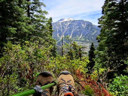
And more up.  I think there were twenty or more, each a hundred yards or so in length.  I finally quit looking up.  Just watching my feet and waiting for the turn which meant another rest period.
IMG_2960 (Medium)

I don’t have the exact altitude for the area we are in, but it’s safe to say that I started the hike at over 8000’ and had to have gained over 500’ on the way up.  For someone that has lived their life at 350’ altitude this was one tough walk, or crawl.

I only took my little point and shot, which was inadequate for the shots I wanted to take across the canyon.  I’m glad I didn’t have the bigger camera though.   I probably would have hung it on a tree for retrieval on the way back down.  Water was running down every crack and crevasse.  Dozens of waterfalls in every direction. 

IMG_2978 (Medium)

IMG_2980 (Medium)

I didn’t know how long the hike would take me, but after a couple of hours of steady climbing, I was about to give it up and turn around.  Was it around the next switchback, or what?  Was I even on the correct trail as I hadn’t seen another trail marker, or any other hikers.

Finally I broke out of the switchbacks onto a more level trail.

IMG_2990 (Medium)

Ouray, from way up there. Looking back into Yankee Boy Basin.

IMG_2993 (Medium)

Around a curve, into some more trees, and saw this.

IMG_3003 (Medium)

Slowly made my way through.

IMG_3000 (Medium)

To this.

IMG_3001 (Medium)

IMG_3005 (Medium)

Not the most spectacular waterfall I’ve seen, but still worth the hike.  Sat there listening to the roar for a few minutes, ate an apple, and thought about all those steps downhill.  As tough as climbing uphill is, going downhill is more dangerous.  Small rocks become ball bearings, and larger ones are just waiting to turn a ankle if you aren’t careful. 

IMG_3024 (Medium)

Only stopped two times on way down.

IMG_3027 (Medium)

Was sure glad to catch this little glimpse of white through the trees. 

IMG_3031 (Medium)

Another on in the books……jc